Michigan Has More Freshwater Coastline Than Any US State — Here’s Why That Matters
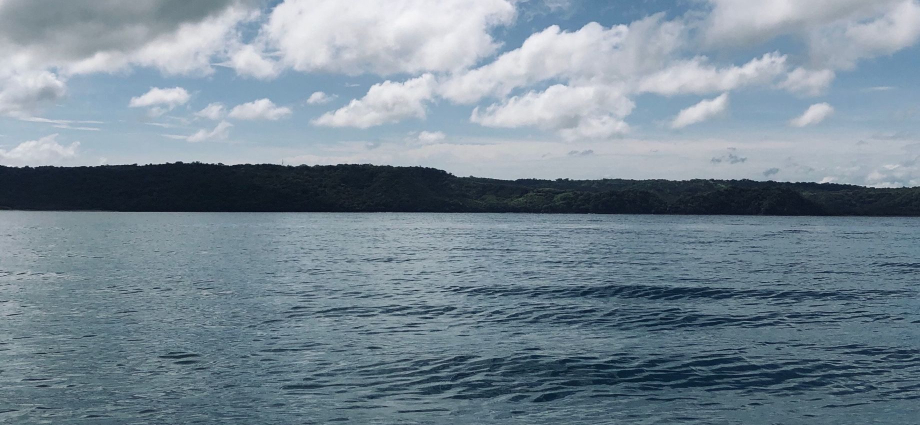
Michigan freshwater coastline stretches an astonishing 3,288 miles, making it the longest freshwater shoreline of any state in the entire United States — more than the entire US Atlantic seaboard. Let that sink in for a moment. From the wild, windswept dunes of Lake Michigan to the ancient red-rock cliffs rising above Lake Superior, Michigan’s relationship with water is unlike anything else on the planet.
I’ve driven, hiked, kayaked, and camped along dozens of these shores, and every single time I’m struck by how different each stretch feels — the smell of cold deep water off the Upper Peninsula, the sugary crunch of sand between your toes near Traverse City, the sound of waves crashing against limestone bluffs at dusk. If you’ve never thought of Michigan as a coastal destination, this article is about to change your mind completely.
The 3,288-Mile Number — and Why It Blows Everything Else Away
When people first hear that Michigan freshwater coastline totals 3,288 miles, they usually think there’s been some kind of mistake. There hasn’t. That number is official, documented by the National Oceanic and Atmospheric Administration, and it dwarfs every other state’s freshwater shoreline without even coming close to a contest. Florida, the state most Americans picture when they think of coastlines, has roughly 1,350 miles of tidal shoreline. Michigan has more than double that — and all of it is freshwater.
The figure includes shoreline along all four of Michigan’s Great Lakes borders — Lake Michigan, Lake Superior, Lake Huron, and Lake Erie — plus the connecting waterways and bays that wind their way into the land. The two peninsulas are the key to understanding it all. Michigan is the only state in the Lower 48 made up of two separate land masses, and that geographic quirk means the water just keeps wrapping around you no matter where you go. Drive across the Mackinac Bridge and you’re surrounded by the Straits of Mackinac on both sides — the point where Lake Michigan and Lake Huron meet in a cold, impossibly blue rush of open water.
Local Tip: If you want to truly feel the scale of Michigan’s coastline in one afternoon, drive M-119 north of Harbor Springs. Called the “Tunnel of Trees,” this road hugs the Lake Michigan bluff so closely that on certain curves you can see the water through the branches below you. It’s one of the most gorgeous coastal drives in America and almost nobody outside of Michigan talks about it.
All Five Great Lakes Touch Michigan — Almost
Here’s one of the most surprising Michigan water facts in the book: Michigan borders four of the five Great Lakes. Lake Michigan, Lake Superior, Lake Huron, and Lake Erie all touch Michigan’s shores. Lake Ontario is the only one that doesn’t. No other state can claim even three. That single geographic fact explains everything about Michigan’s identity — why the state smells like cold water and pine, why summer feels sacred here, why locals plan their whole year around the brief, brilliant stretch of July and August when the lakes warm up just enough to swim.
Lake Michigan
The western shore of the Lower Peninsula faces Lake Michigan, and this is where you’ll find the iconic dune country, the fruit belt, and some of the most photographed sunsets in the Midwest. The water here runs a wild gradient of color — deep cobalt out past the sandbars, then teal, then pale jade in the shallows. Lake Michigan beaches are consistently ranked among the best freshwater beaches on earth, and after one visit you’ll understand why that’s not an overstatement.
Lake Superior
The largest of the Great Lakes by surface area, Superior is a different animal entirely. Cold, deep, and relentless, it commands respect in a way the other lakes don’t always demand. The water temperature rarely climbs above 55 degrees even in late summer. What it lacks in swimming weather it more than makes up for in raw, jaw-dropping scenery — especially along the Pictured Rocks corridor, where mineral-streaked sandstone cliffs rise 200 feet straight out of the lake.
Lake Huron and Lake Erie
Lake Huron forms Michigan’s entire eastern border and wraps around the top of the Lower Peninsula through Georgian Bay and the North Channel. Lake Erie only clips the very southeastern corner of the state, but it contributes to the total Michigan coastline miles count nonetheless. Huron, in particular, is wildly underrated — its northern shore near Rogers City and Alpena offers crystal-clear water, shipwreck diving, and some of the best Petoskey stone hunting in the state.
Michigan Coastline Miles by Lake — A Quick Comparison
| Great Lake | Michigan Shoreline (approx.) | Notable Feature | Best Season to Visit |
|---|---|---|---|
| Lake Michigan | 1,638 miles | Sand dunes, beach towns, sunsets | June – September |
| Lake Superior | 1,056 miles | Pictured Rocks, waterfalls, wilderness | July – October |
| Lake Huron | 561 miles | Shipwrecks, Petoskey stones, Mackinac | June – September |
| Lake Erie | 33 miles | Warm water, fishing, proximity to Detroit | May – September |
| Total | 3,288 miles | Longest freshwater coastline in the US | Year-round |
What Makes the Michigan Great Lakes Shoreline So Extraordinary
Raw mileage is impressive, but what truly sets the Michigan Great Lakes shoreline apart is the sheer variety packed into those miles. Within a single weekend road trip, you can go from white-sand beach towns reminiscent of the Caribbean to ancient boreal forest pressing right down to the water’s edge. The geology shifts dramatically — sandstone in the east, limestone in the north, dune sand along the west, and the ancient Precambrian granite of the Upper Peninsula forming shorelines that look like they belong in Scandinavia.
The Dune Country
Nowhere is the coastal drama more theatrical than at Sleeping Bear Dunes, where mountains of sand — some reaching 450 feet above the lake — plunge almost vertically into Lake Michigan. The climb up the dune face is brutal, warm sand sliding back under your feet with every step, but the view from the top stops conversation cold. Blue sky, blue lake, green islands in the distance. Worth every step.
Island Life
No conversation about Michigan’s coastline is complete without Mackinac Island, the car-free jewel sitting in the Straits of Mackinac. Step off the ferry and your senses immediately recalibrate — the smell of fudge and horse manure mixing in the lake breeze, the clop of hooves on pavement, the cold spray coming off the straits. It’s unlike anywhere else in the country.
Pro Tip: The best time to visit Mackinac Island is mid-September after Labor Day crowds thin out. Rates drop significantly, the fall colors start pushing in from the mainland, and you can actually hear the lake from the front porch of the Grand Hotel without someone’s kid splashing in a pool 50 feet away. I’ve done it both ways — September wins every time.
Best Spots to Experience the Coastline Right Now
You could spend a month exploring Michigan’s shores and still feel like you’d only scratched the surface. But if you’re planning your first serious coastal trip, here are the stretches I keep coming back to.
The Upper Peninsula
The Upper Peninsula is where the coastline gets genuinely wild. Pictured Rocks alone covers 42 miles of Lake Superior shoreline, but the UP stretches far beyond that — east to the Tahquamenon River emptying into Whitefish Bay, west to the Porcupine Mountains above Lake of the Clouds. Pair your trip with some Michigan waterfall hunting and you’ll never want to leave.
Traverse City and the Leelanau Peninsula
Traverse City sits at the southern tip of Grand Traverse Bay, with warm, clear water on both sides of the Old Mission Peninsula. In July, it hosts the famous National Cherry Festival right on the waterfront. The surrounding Leelanau Peninsula is lined with sandy beaches, tucked-away coves, and some of the best Michigan wine trail stops in the state — all within sight of the lake.
Holland and the Southwest Shore
Holland Michigan anchors one of the most accessible and beautiful stretches of Lake Michigan coastline, with a state park beach that consistently ranks among the top Michigan beaches in any given year. The piers, the lighthouses, and the channel connecting Lake Macatawa to Lake Michigan make for a scenic evening walk after dinner.
Michigan Water Facts You Probably Didn’t Know
The Michigan freshwater coastline stat is just the beginning. Michigan water facts go surprisingly deep.
Michigan sits atop roughly 21 percent of the world’s surface freshwater supply, shared with the other Great Lakes states and Ontario. The Great Lakes hold more than 6 quadrillion gallons of water. Lake Superior alone is so large that it could cover all of North and South America in a foot of water. The average depth of Lake Michigan is 279 feet, but it drops to 923 feet at its deepest point — cold enough and dark enough down there that it has preserved hundreds of shipwrecks in near-perfect condition for over a century.
Michigan also has more than 11,000 inland lakes — actual lakes, not ponds. Add those shorelines together and the number of water-touching land in this state starts to feel almost incomprehensible. For a state with no ocean access, Michigan is one of the most water-defined places in the world. The organization Pure Michigan has built the state’s entire tourism identity around this fact, and honestly, it’s warranted.
Planning Your Michigan Coastal Trip
Whether you’re planning a weekend or a full two-week loop of the peninsulas, the Michigan Great Lakes shoreline rewards every level of traveler. Families will find calm, sandy-bottomed bays perfect for little ones. Adventurers can tackle serious Michigan hiking trails that run right along the cliff edges above Superior. Paddlers can spend days exploring river mouths and protected bays on a Michigan kayaking trip without ever seeing the same view twice.
For overnight stays, your options range from full-service Michigan state parks with lakeside campsites to cozy Michigan cabin rentals tucked into the dunes, to fully equipped Michigan glamping setups where you wake up to the sound of waves without having to inflate anything. Budget travelers will be glad to know there are plenty of free things in Michigan along the coast — public beaches, lighthouse walks, and sunset-watching spots that cost absolutely nothing.
Frequently Asked Questions
How many miles of freshwater coastline does Michigan have?
Michigan has 3,288 miles of freshwater coastline, the most of any state in the US. This figure accounts for shoreline along Lake Michigan, Lake Superior, Lake Huron, and Lake Erie, plus connecting straits and bays.
Which Great Lakes border Michigan?
Michigan borders four of the five Great Lakes: Lake Michigan, Lake Superior, Lake Huron, and Lake Erie. Only Lake Ontario does not touch Michigan, making it the only state in the contiguous US to border four Great Lakes.
Is Michigan’s coastline longer than Florida’s?
Yes. Michigan’s 3,288 miles of freshwater coastline exceeds Florida’s roughly 1,350 miles of tidal shoreline. Michigan also surpasses Florida in total coastline if you count all inland lake and river shorelines.
What is the best time of year to visit Michigan’s coastline?
Late June through September is peak season for swimming and beach visits, but fall — particularly September and October — offers stunning color, smaller crowds, and cooler temperatures perfect for hiking and kayaking along the shores.
What are the most scenic stretches of Michigan coastline?
The Pictured Rocks National Lakeshore on Lake Superior, the Sleeping Bear Dunes National Lakeshore on Lake Michigan, the Tunnel of Trees stretch of M-119, and the Leelanau Peninsula near Traverse City are consistently considered the most scenic and are worth planning your entire trip around.
Does Michigan really have more coastline than any ocean state?
In terms of freshwater coastline specifically, yes — Michigan leads all states. Some ocean-bordering states have more total tidal coastline when every tidal creek and inlet is measured, but for continuous, swimmable, drinkable freshwater shoreline, no state comes close to Michigan’s 3,288-mile count.
Michigan’s 3,288-mile freshwater coastline isn’t just a trivia fact — it’s the backbone of everything that makes this state worth exploring. Whether you’re discovering Michigan hidden gems on a solo road trip, chasing Michigan fireworks over water on a summer night, bringing the whole family for a Michigan trip with kids, or mapping out the ultimate Michigan road trip along the lakeshore, you’ll keep coming back to the water. Every stretch of this coast has its own personality, its own smell, its own season, its own reason to return. I’ve been returning for years, and I’m nowhere close to running out of new shoreline to stand on.