Michigan’s Upper Peninsula Size Will Blow Your Mind — It’s Bigger Than 4 US States Combined
The Michigan Upper Peninsula size is one of those facts that stops people mid-conversation. When I first moved to Michigan and someone told me the UP was larger than four US states combined, I genuinely thought they were exaggerating. They were not. Stretching across 16,452 square miles of forests, shoreline, waterfalls, and wilderness, the Upper Peninsula is a place so vast and so wildly underexplored that it feels less like a part of the Midwest and more like a lost corner of the American frontier.
If you have ever wondered how big is Michigan Upper Peninsula, the short answer is: much bigger than you imagine. The long answer is what this article is all about — and once you understand the sheer scale of this place, you will understand why a single trip never feels like enough.
Just How Big Is the Michigan Upper Peninsula?
The Michigan Upper Peninsula size clocks in at approximately 16,452 square miles, which makes it roughly 29 percent of Michigan’s total land area — despite holding only about 3 percent of the state’s population. That population-to-land ratio tells you everything. You can drive for an hour through the UP and not pass a single stoplight. You can hike a trail and go half a day without seeing another person. The air smells like pine resin and cold lake water. The silence is so complete it has a texture to it.
To put those numbers into even sharper relief, the UP is home to more than four million acres of national forest, over 150 named waterfalls, and nearly 1,700 miles of Great Lakes shoreline. It borders Lake Superior, Lake Michigan, and Lake Huron — three of the five Great Lakes. No other place in the continental United States offers that kind of freshwater coastline in one relatively contained region.
Local Insider Tip: Most visitors underestimate drive times in the UP. Google Maps will tell you a destination is 90 minutes away, but the two-lane roads, deer crossings, and sheer number of “wait, what was that?” pullover moments mean you should always budget at least double the time you think you need.
Which US States Is the Upper Peninsula Larger Than?
Here is where UP Michigan facts get genuinely jaw-dropping. The Upper Peninsula is larger than the states of Connecticut, Delaware, Rhode Island, and New Jersey — combined. Read that again. One peninsula in one state outpaces the combined land area of four entire US states. The table below breaks it down so you can really feel the scale.
| Region / State | Land Area (sq miles) |
|---|---|
| Michigan Upper Peninsula | 16,452 |
| Connecticut | 4,842 |
| Delaware | 1,949 |
| Rhode Island | 1,034 |
| New Jersey | 7,354 |
| CT + DE + RI + NJ Combined | 15,179 |
The UP still comes out ahead. And yet, if you ask someone from New Jersey how big their state feels, they will tell you it takes forever to drive across. The Upper Peninsula is larger than all of them put together, and it contains a fraction of the people. That is not just a fun fact — it is the entire reason the UP feels the way it does when you are standing on a cliff above Lake Superior at dawn, watching the fog lift off water so blue it looks digitally enhanced.
The Population Contrast
Those four states collectively house around 15 million people. The Upper Peninsula? About 300,000. That means for every single person living in the UP, there are roughly 50 people living in those four smaller states. The wilderness is not a marketing angle up here. It is just the reality of daily life.
Why the UP Feels Wild and Undiscovered
I have traveled a lot of Michigan, from Detroit to Traverse City to the dunes of the Lower Peninsula. But nothing quite prepares you for crossing the Mackinac Bridge and feeling the character of the landscape shift beneath your tires. The trees get taller and closer together. The towns get smaller and farther apart. Cell service becomes a suggestion rather than a guarantee.
That wildness is a direct consequence of the Michigan Upper Peninsula size. With so much land and so few people, the forests have had room to breathe for centuries. Moose wander through wetlands. Black bears cross two-lane highways at dusk. You can kayak through sea caves at Pictured Rocks and feel genuinely exploratory, not like you are checking a box on a tourist itinerary.
Local Insider Tip: If you want to experience the UP the way locals do, skip the peak July weekend crowds at Pictured Rocks and visit in late September instead. The crowds thin, the maples catch fire with color, and the light on the sandstone cliffs turns the whole shoreline amber and gold. I have done it both ways, and it is not even close.
The Sound and Feel of True Wilderness
There is a specific sound the UP makes at night that I have not heard anywhere else in the Midwest. Loons calling across a still lake. Wind moving through white pines. Water — always water somewhere, because you are never far from a river, a lake, or a waterfall. The UP contains some of the most spectacular Michigan waterfalls in the state, including Tahquamenon Falls, which runs the color of root beer thanks to tannins leaching from the surrounding peat bogs. Standing next to it, you feel the mist on your face and smell something ancient and clean.
What the Michigan Upper Peninsula Size Means for Travelers
Understanding how big is Michigan Upper Peninsula is not just trivia — it fundamentally changes how you plan a trip. The UP is not a weekend destination you can “do.” It is a place you return to, each time peeling back another layer. Here is what the scale means practically:
You need to pick a region and commit to it rather than trying to sprint from one end to the other. The western UP around Copper Harbor and the Keweenaw Peninsula has a completely different personality from the eastern UP near Sault Sainte Marie. Both are extraordinary. Both deserve their own trip. Michigan road trips through the UP work best when you anchor yourself to one area and explore deeply rather than covering miles for their own sake.
Where to Sleep in the UP
Your lodging options are as varied as the landscape. Serious wilderness lovers will want to check out Michigan camping near the water, where falling asleep to the sound of Lake Superior waves is an experience that genuinely resets something in your nervous system. For something with a mattress and a wood-burning fireplace, Michigan cabin rentals in the UP range from rustic to surprisingly luxurious. And if you want the forest experience without sacrificing comfort, Michigan glamping options have expanded significantly in recent years.
Top Regions of the UP to Explore
The UP Michigan facts that matter most to travelers are not the numbers — they are the places. Here is a quick orientation to the major regions and what makes each one worth the drive.
Eastern UP: History and Waterways
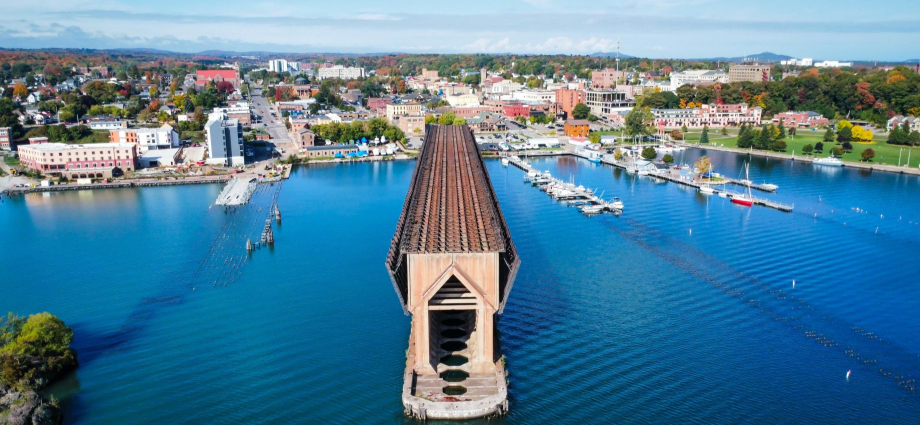
The eastern end of the UP is where you find the Soo Locks, Tahquamenon Falls, and easy ferry access to remote islands in Lake Huron. This part of the peninsula is also where the Michigan lighthouses feel most dramatic, perched on rocky points where Lake Huron and Lake Superior push against each other in the Straits of Mackinac. From here, Mackinac Island is just a ferry ride away — technically part of the island archipelago between the two peninsulas, and one of the most uniquely preserved places in the entire state.
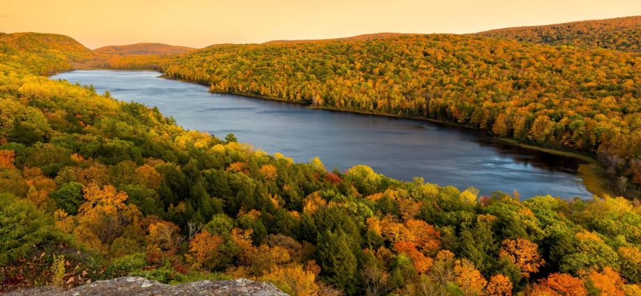
Central UP: Pictured Rocks and Waterfalls
The central UP is anchor territory for most first-time visitors, and for good reason. Pictured Rocks National Lakeshore delivers sandstone cliffs streaked with mineral colors — iron reds, copper greens, calcium whites — rising straight from the clearest water you have ever seen outside of the Caribbean. Nearby, you can find some of the best Michigan hiking in the state, plus Michigan kayaking routes that let you paddle directly under those famous cliffs. The sound of water dripping from cave walls and lapping against your hull is something I think about long after I get home.
Western UP: Copper Country and Remote Wilderness
The Keweenaw Peninsula, jutting into Lake Superior like a pointing finger, is the most remote and the most rewarding corner of the UP. Former copper mining towns have reinvented themselves as destinations for Michigan state parks lovers, mountain bikers, and anyone who wants to feel genuinely far from the rest of the world. The Michigan hidden gems density up here is extraordinary — ghost towns, abandoned mine shafts, stretches of shoreline where you can walk for miles and never see another person.
Planning Your Upper Peninsula Adventure
The best time to visit the UP is a matter of what you are after. Summer (late June through August) delivers warm enough days for swimming in Lake Superior — though “warm” is relative, since the water rarely climbs above 60 degrees. Fall brings the color show. Winter transforms the UP into a snowmobile and cross-country skiing paradise, with some areas receiving over 200 inches of snow per year. Spring is short and muddy but laced with wildflowers and rushing snowmelt waterfalls.
For official trip planning resources, Pure Michigan maintains excellent guides to lodging, trails, and seasonal events across the peninsula. I use it every time I start sketching a new UP itinerary.
Frequently Asked Questions
How big is Michigan’s Upper Peninsula exactly?
The Michigan Upper Peninsula size is approximately 16,452 square miles, making it larger than the combined land area of Connecticut, Delaware, Rhode Island, and New Jersey. It represents about 29 percent of Michigan’s total land area.
How many people live in the Upper Peninsula?
Roughly 300,000 people live in the UP, spread across 15 counties. That gives it one of the lowest population densities of any region east of the Mississippi River, which is a big part of why it feels so wild and uncrowded.
What Great Lakes does the Upper Peninsula border?
The UP borders three of the five Great Lakes: Lake Superior to the north, Lake Michigan to the south, and Lake Huron to the east. That gives it nearly 1,700 miles of Great Lakes shoreline — more than many entire coastal states.
Is the Upper Peninsula its own state?
No, though the idea has come up more than once in Michigan’s history. The UP is firmly part of Michigan and has been since Michigan achieved statehood in 1837. However, UP residents sometimes jokingly refer to themselves as “Yoopers” and maintain a strong regional identity distinct from the Lower Peninsula.
What are some must-see spots in the Upper Peninsula?
Pictured Rocks National Lakeshore, Tahquamenon Falls, the Keweenaw Peninsula, Porcupine Mountains Wilderness State Park, and the Presque Isle waterfalls are all essential. The UP rewards slow travel — the more time you give it, the more it gives back.
The Michigan Upper Peninsula size is ultimately an invitation. It is the promise that no matter how many times you visit, there will always be a trail you have not walked, a lake you have not paddled, a waterfall you have not heard. If this article has you ready to start planning, explore our guides to things to do in the Upper Peninsula, the best Michigan beaches for a summer escape, and the most spectacular Michigan waterfalls worth chasing across the peninsula. If you are coming from the south, our Michigan road trip guides will help you piece together a route that does the journey justice. The UP is waiting — and unlike the crowds at more famous destinations, it is genuinely happy to have you all to itself.